By Madli-Maria Naulainen, Kuressaare Gymnasium, Estonia
Introduction to the Practice
IT learning environments can effectively assist history teachers and educators in their daily practices by stimulating students' engagement, creativity and ability to understand historical events and processes. This teaching practice presents 4 digital tools which fulfil these goals. By using Google Maps, students can combine their historical knowledge with the aim to develop greater geographical literacy. Tricider, a simple brainstorming and voting application, is capable of facilitating discussion in the classroom. Finally, through applications like Canva and Padlet students gain an insight into how to design infographics or historical timelines.
Applying the Practice
For this teaching practice, Madli-Maria Naulainen combined four digital tools which can be applied to history education.
Google Maps on Google Drive
Developing historical competences can be combined with geographical and map literacy. This can be achieved by using digital tools such as Google Maps in Google Drive. Google Maps can be adapted for the purposes of a history lesson in several ways.
Localising and placing in the historical context spaces and buildings
By employing Google Maps, it becomes possible for students to immediately relate famous historical buildings with a specific place on the map. For instance, this activity can help visualise the geographical scope and the cultural role of heritage in the Roman Empire. The teacher can also ask students to look for relevant information and pictures. In this way, not only students can localise historical landmarks such as the Colosseum or Segovia Aqueduct but also discuss their function, significance and broader historical context.
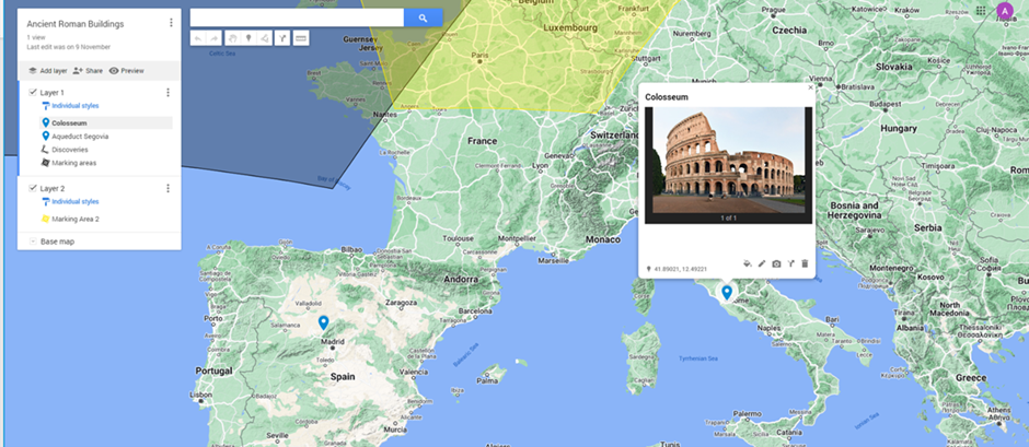
Mapping routes of historical travels, endeavours or conquests
Google Maps can make historical developments more visually explicit and compelling. Its toolkit allows drawing straight or curved lines which can signify trade routes, travel destinations or directions of conquests. For instance, this functionality can be used to discuss the topic of European exploration and colonisation of South and North Americas (from 15th onwards).
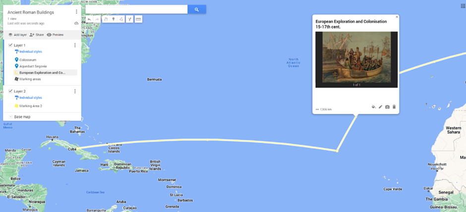
Marking historical areas
Apart from pinpointing specific places and routes, it is also possible to mark areas, regions or countries. By adding layers to the marked spaces, students can make use of differing qualities of the map. This should be considered as particularly valuable while discussing historical processes and their impact on different parts of the world.
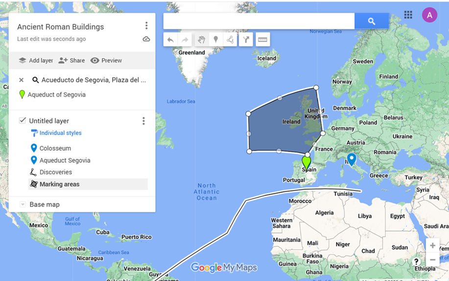
Tricider
Tricider is a small web-application which supports engagement, discussion and voting in the classroom. Prior to the class, the teacher should think of an open question/statement which can be integrated into the content of the lesson (i.e., What was the most influential figure of the 20th century?). After adding the question to Tricider the teacher can invite students to share their views online. In this case, they can include their own historical figure but also can vote whether they agree or disagree with ideas of their colleagues by indicating pros and cons. Ultimately, this tool serves to enhance the engagement of students in the classroom as well as their ability to formulate and justify their arguments.
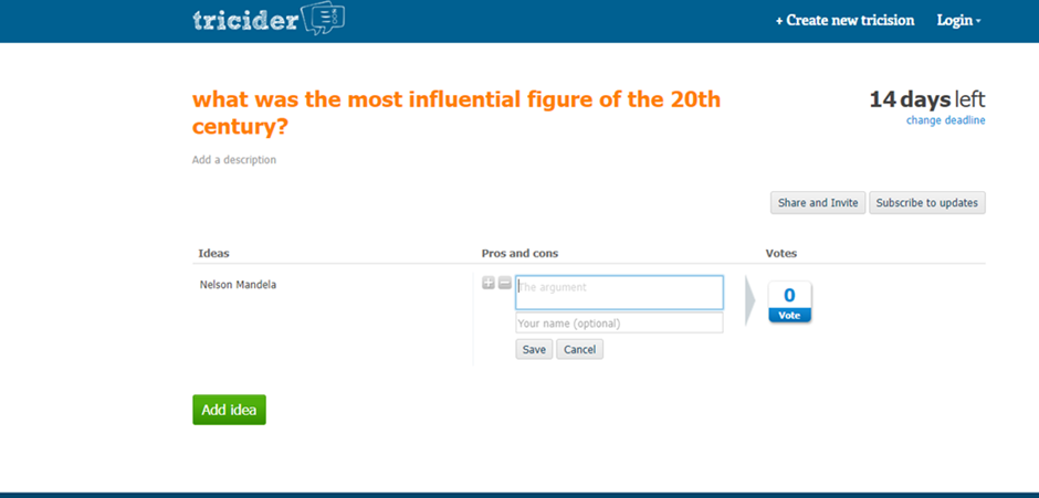
Padlet
Padlet is an educational tool which allows to gather a whole range of online activities and tasks in one place, keep them accessible and ensure good communication between students and the teacher. It supports a large variety of file types.
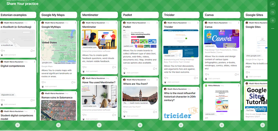
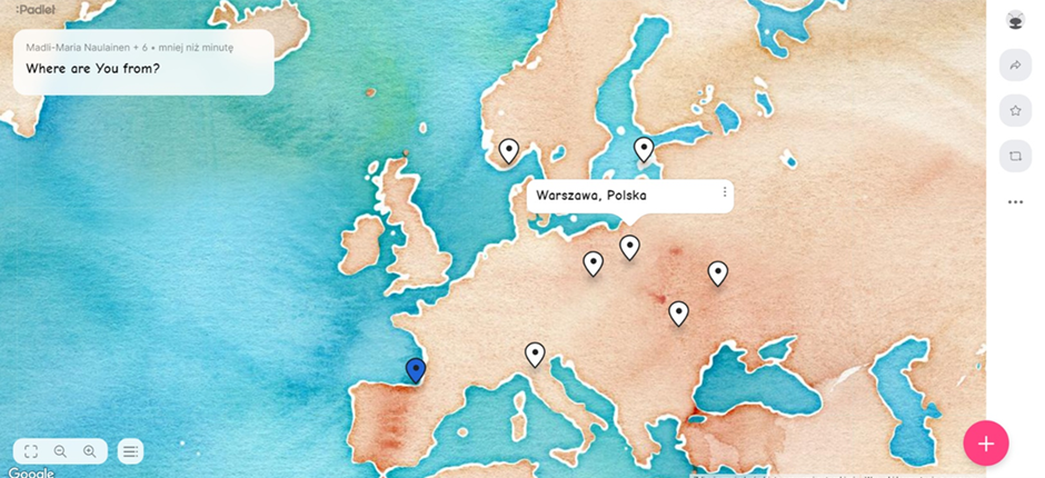
In addition, Padlet offers its localisation and time features that can assist the creation of historical maps and timelines.
Canva
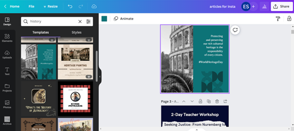
Canva is a free design tool which offers a wide range of features that can be used in the classroom. It contains ready-made templates of infographics, timelines , mind maps, advertisements or presentations. Depending on the assigned task, students can easily share their work with colleagues, save it in the pdf format or print it out. Teachers can also provide their students with a dedicated material (this can be particularly useful if one would like to employ digital historical sources i.e pictures) by uploading it directly to Canva.
Potential obstacles, lessons learned
There might be some inconvienence with the accounts needed to be created in order to use those applications or programs. But if that is done beforehand, the usage should go smoothly. Also, some apps have limited possibilities, for instance Padlet has only 3 free walls for a new user, but there are options to archive the older walls and start new ones or create more accounts if the PRO-version is not the option.
Target age group: 6th grade to university students
Time : depending on the assignment, 45 minutes
Didactic medium used: digital tools like Google Maps, Tricider, Padlet and Canva
The goal: Using digital tools to combine the development of historical competences with geographical and visual literacy and enhance communication in the classroom
About the author
Madli-Maria Naulainen has worked as a teacher for two decades now in Kuressaare, Saaremaa, Estonia. She has a lot of experience using and creating digital input in teaching, she works as an educational technologist in her school, being responsible to train the school teachers in digital competences. Madli-Maria has long been a partner to Tallinn University, guiding the history-teacher students on the digital possibilities in history and civics education. She has also been part of many projects with the aim to create digital materials for history teachers.
Written by Adam Dargiewicz on the basis of Madli-Maria Naulainen’s presentation during LTT Seminar in autumn 2022. This was done as part of the collection of teaching practices for the Critical History project with co-funding of the Erasmus+ Programme of the European Union.
The European Commission’s support for the production of this publication does not constitute an endorsement of the contents, which reflect the views only of the authors, and the Commission cannot be held responsible for any use which may be made of the information contained therein.

